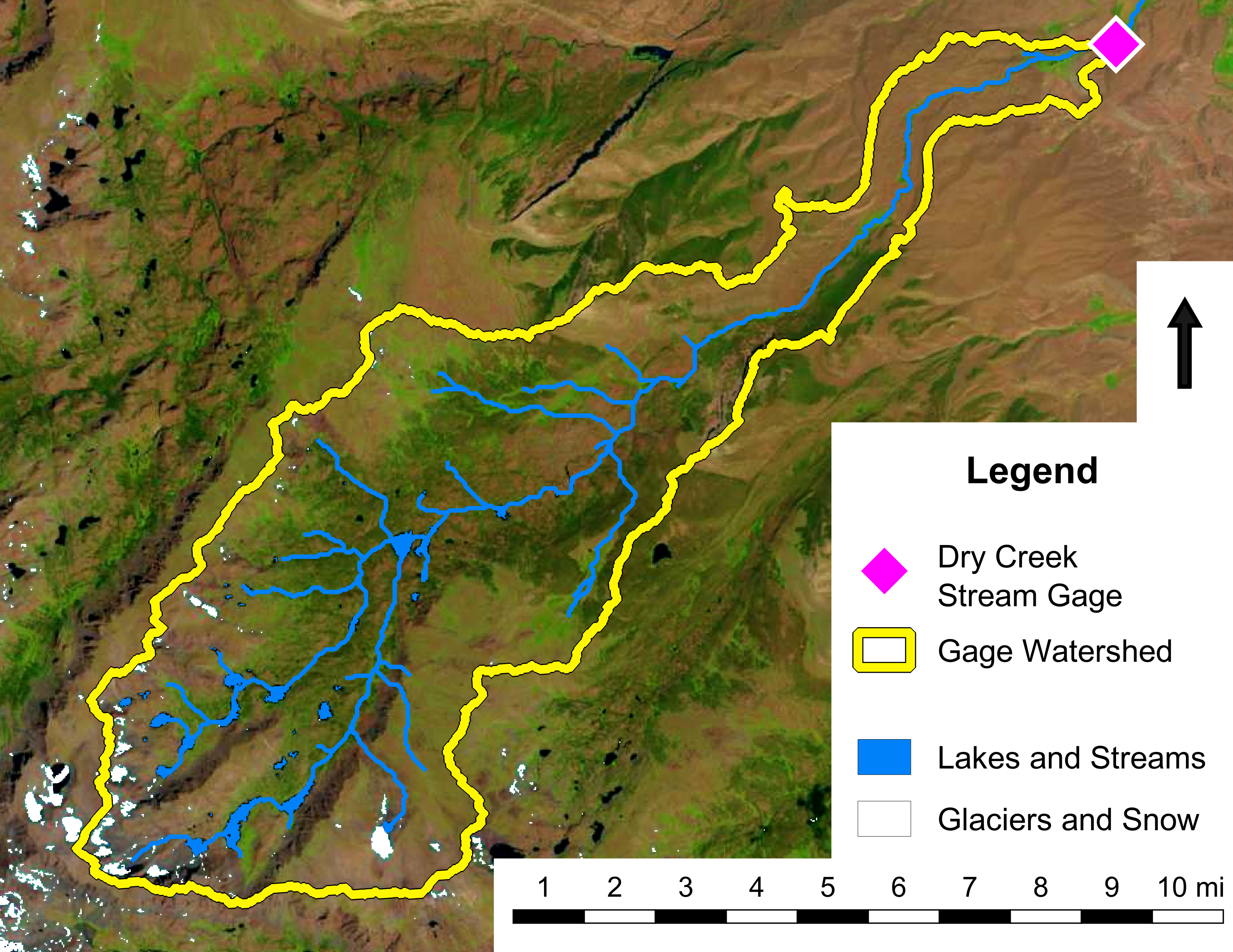
Real-time and archival stage record for the Dry Creek stream gage, operated by the Wind River Mountain Research Lab, located at the historic location of USGS Gage #06222500 above the headworks of the Dry Creek Canal, near Burris, Wyoming.
Wind River Mountain Research Lab Stream Gage #2
Stage data are recorded every 15 minutes (barring technical difficulties) and converted to volumetric discharge rates using a Bayesian power-law rating curve developed from in-situ streamflow measurements. Daily and 15-minute records are available upon reasonable request.
NOTE: Gage may be impacted by ice during cold weather.
Fast facts about this stream gage:
• Installed on 9/23/2022 by Boardman et al., record begins 10/1/2022
• Gage datum surveyed from USGS benchmark
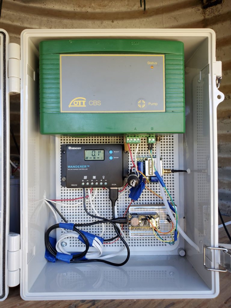
• OTT Compact Bubble System automatic stage sensor, ± <0.02 ft. accuracy
• Arduino data recording at 15-minute intervals
• Iridium satellite transmission every 75 minutes
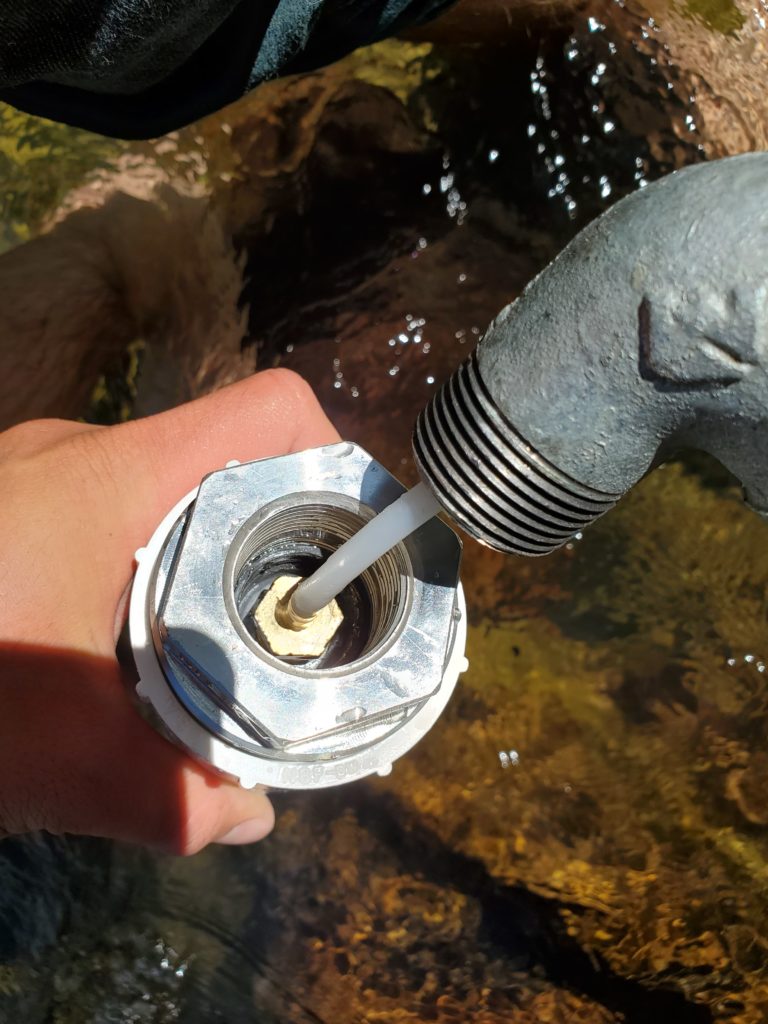
• Discharge measured with USGS Type AA current meter
• With thanks to the Wind River Water Resources Control Board and the Eastern Shoshone Tribe and Northern Arapaho Tribe for installation permission and ongoing collaboration on this project